File:NaybraTopographical.jpg
From NSWiki

Size of this preview: 797 × 599 pixels. Other resolutions: 798 × 600 pixels | 1,306 × 982 pixels.
Original file (1,306 × 982 pixels, file size: 538 KB, MIME type: image/jpeg)
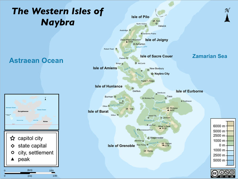
First Rendition of the Official Topographical Map of the Western Isles of Naybra. - Created 02/08/14 by Naybra - Credit to Knight Errant of JuniorGeneral for inspiration and color and Tutorial. - Additional Credit to the New Lowlands for creating the original outline of Naybra.
File history
Click on a date/time to view the file as it appeared at that time.
| Date/Time | Thumbnail | Dimensions | User | Comment | |
|---|---|---|---|---|---|
| current | 00:47, 3 March 2014 | | 1,306 × 982 (538 KB) | Naybra (Talk | contribs) | Second Rendition of the Official Topographical Map of the Western Isles of Naybra. - Created 03/02/14 by Naybra - Credit to Wikipedia:WikiProject Map for inspiration and color, legend, compass, and design Template. - Additional Credit to the New Lo... |
| 00:41, 3 March 2014 | Error creating thumbnail: File missing | 1,600 × 1,200 (267 KB) | Naybra (Talk | contribs) | First Rendition of the Official Topographical Map of the Western Isles of Naybra. - Created 02/08/14 by Naybra - Credit to Knight Errant of JuniorGeneral for inspiration and color and Tutorial. - Additional Credit to the New Lowlands for creating t... |
- You cannot overwrite this file.
File usage
The following page links to this file:
